
It's impossible to travel the northwest without following in the footsteps of Lewis and Clark, a point really driven home to me on Wednesday, Aug. 3, as we crossed the bridge from Lewiston, Idaho, to Clarkson, Wash.
We followed the Snake River on US 12 for a few miles until the river became a lake and the highway veered a bit to the south and climbed along a stream bed into southeastern Washington's rolling hills of pastures and wheat farms.

Leaving Lewiston, Idaho, we struck out over the rolling prairies of southeastern Washington. This secondary road near Pomeroy, Wash., demonstrates the challenge the wheat farmers face in those parts.
While the landscape didn't flatten out entirely, as we passed Walawala and approached Yakima it settled down into orchards and vineyards. Fruit stands beside the road offered ripe cherries for $1 a box, among other offerings.

Stopping for fuel in Pasco, Wash., we spotted the "Huli Huli Hawaiian Grill" -- another sign of Hawaiian life in the universe.

Steve had recommended Lolo Pass, followed by White Pass through Snoqualmie. Although we had to stop several times because of road construction, this route provided amazing views, like this one of Mt. Rainier.

Left to right: Rainier, David and Flanman.

We're told the view of Rainier isn't often this good.
One stop for construction in White Pass took nearly an hour, as crews cut trees and cleared the roadside below us and we got acquainted with some of our fellow travelers, who included a couple of truck drivers using the pass to avoid the hassle of truck weigh stations on the Interstate and a group from Wyoming pulling trailers with five horses, feed and equipment inside.
"What kind of horses are they?" I asked one of the drivers.
"Warmbloods," he answered. "They're a type of carriage horse used in competitions and we're headed to a meet."
I'd heard of Thoroughbreds, Morgans, quarter horses and various draft horse and pony breeds, but Warmblood was new to me. Coming from Wyoming, you'd expect these guys to be headed to a rodeo, but their sport was putting teams of highly trained, expensive, imported horses through their paces pulling a carriage. "It's like dressage," he said.
Eventually, we were down from the pass and looking for where we'd turn to ride some 37 miles up to see Mount St. Helens. The road which leaves US 12 at Randall, is only open in the summer and features overlooks where you can see the volcano and the damage from the May 18, 1980, eruption, which blew down or scorched 230 square miles of forest and killed 57 people and countless animals.

Mount St. Helens is miles away from these trees, killed by its eruption but still standing 31 years later.

From a Mount St. Helens overlook, we got a spectacular view of Mt. Rainier.

One end of Spirit Lake is still covered by floating logs, the remainder of trees felled by the eruption. According to scientists, the logs eventually submerge vertically, because of the larger mass of their root ends, and sink to the bottom where the mineral-laden volcanic ash causes them to petrify into upright transplanted stumps.

While some of the forest has been replanted, much of it is still slowly recovering. The top of the crater, which is now about 1,300 shorter than before the eruption, can be seen in the distance.

More than 30 years after the eruption, evidence of the event is still plain to see.
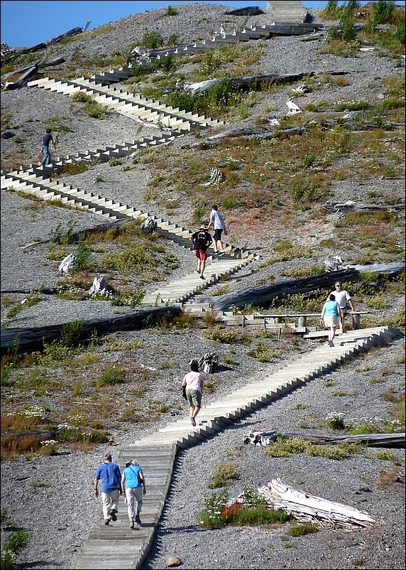
At the closest overlook, there are steps to climb even higher for a better view of the crater.
After our St. Helens visit, we came back down the 37-mile road to Randall and found a campsite at a golf course/RV park. We pitched our tents near a huge cherry tree -- it must have been 60 feet tall or more -- laden with ripe fruit. We were standing under the tree when a flock of birds landed in the top branches and it began raining cherries. I tried a few; they were small, but sweet.
In the morning, we ate breakfast in Randall and then continued west on US 12 until it connected with US 101 in Aberdeen. From there, we headed north through the rain forests until we eventually emerged on the shore of the Pacific, completing my third transcontinental motorcycle journey.
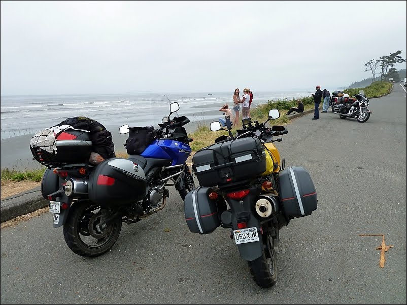
Our first view of the Pacific Ocean was at Kalaloch Beach in Olympic National Park.

Staying on 101, we continued north and then east along Lake Crescent, also in the Olympic National Park, until we arrived at Port Angeles, Wash.
That night, we had a tasty Thai dinner in Port Angeles and checked out the schedule for the ferry to Victoria, British Columbia, just across the Strait of San Juan de Fuca. The first boat Friday morning would leave at 8:30. We weren't sure where we'd go after we arrived in Canada, but it occurred to me that David Black, who owned the newspaper where I used to work, lived in Victoria. I gave him a call to ask advice and he invited us to stop at his house next day.
David was up at 4:45, determined not to be left behind. I got up grudgingly at 5:30 and refused to talk until I'd had some coffee. We parked the bikes at the ferry landing, bought tickets and went for breakfast.

At about 8 a.m., the Ferry Coho arrived to pick up passengers headed to Victoria.
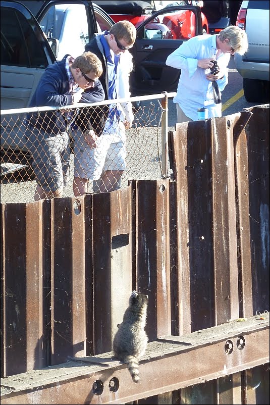
While we were waiting for the Coho, a chubby raccoon walked by, squeezed through a hole in the fence and found his way out on a beam, looking for treats from the waiting passengers.

Mr. Raccoon was particularly fond of salted almonds.

The fog was still rising over Port Angeles when the ferry departed for Canada.

Outside the Victoria harbor, the Russian ship Pallada was at anchor. The sailing vessel is visiting Victoria, San Francisco and, later, Honolulu this summer.

We landed in Victoria, a city that looks a bit like a Walt Disney theme park, with a lovely old hotel, the Empress, dominating the skyline.
Crossing the border in Victoria, I was sent by the immigration officer to "Area 3" to await another officer who would ask more questions. Meanwhile, David passed through quickly and disappeared up the ramp into the city.
During my 20-minute wait for the second officer, I watched while another customs officer, a woman, took apart a car in "Area 2" while the two occupants watched. She was going through a backpack, shuffling and scanning a stack of papers and envelopes and stuffing them back, when my officer number two arrived. I gave him my passport and entry form, which bore only the comment "no reservation on ferry." He took them, said "We have to do an identity check," and disappeared for another 10 minutes.
When he came back, he asked me to name all the states where I've lived. I went through the list and he said, "What about Minnesota?"
I said, "I spent the weekend there two weeks ago at my sister-in-law's, but I've never lived there."
He said "OK," gave me back my passport and said I was free to go. I asked if not having a reservation to ride the ferry was a problem leading to my being sent to "Area 3." He said no -- there were "a combination of factors."
Luckily, David was waiting just outside the gate and his GPS still worked. Mine, however, only had maps of New Brunswick and Nova Scotia. Moreover, David's T-Mobile cell phone had no signal and wouldn't again even after we got back to the U.S.
My Verizon phone had service, but it was on "Extended Roaming" and I was receiving text messages warning me to turn off "Data Roaming" or pay the expensive consequences. David's iPad used AT&T's 3G network, which was proving to be spotty in the U.S. and non-existant in Canada. We stopped at a gas station and bought a map.

Newspaper tycoon David Black, a former employer of mine who lives in Victoria, graciously invited us to stop for lunch at his ocean-side home, which was formerly the U.S. consulate in Victoria. Here, he shows us the view from an upstairs room he recently remodeled.

We decided to ride up to Nanaimo and take a second ferry from Departure Bay on Vancouver Island to Horseshoe Bay, just north of the city of Vancouver on the mainland, and then ride up to Whistler, site of the 2000 Winter Olympics.

We found a campground -- a new one with sparkling new plumbing, electrical hookups and bathrooms, but a bit raw landscape-wise -- south of Whistler, where this was the view of the morning sunrise.

After an evening tour of the Olympic playground, we set out in the morning to ride a loop from Whistler to Lillooet, down the Frazier River to Hope, B.C., and back into the U.S. We think this is Wedge Mountain but David and I disagree on what made the nearly vertical the tracks in the snow near the summit. He says rockfalls; I say skiers delivered by helicopter.

This view of Duffy Lake, between Whistler and Lillooet, is almost too perfect ...

... so I took another shot with the bike in it to prove we didn't just buy a post card.

If you click on this picture to make it larger, and then look closely at the edge of the lake, you'll see railroad tracks. This is at Seton Lake, a reservoir near Lillooet, which bills itself as "Truly Rugged."
The road from Lillooet to Hope, B.C., along the Frazier River is spectacular, but there are almost no overlooks or places to stop to take photos. So, unfortunately, you'll just have to check it out online.
From Hope, we rode west and crossed the border at Sumas, Wash. It was late Saturday afternoon and we needed to find a place to stay. Happily, most of our mobile devices were working again: GPS, iPhone and iPad -- the T-Mobile phone was still out of service. Electronically enabled, we were able to find a KOA in Birdsview, Wash., east of Bellingham and, after a pleasant hour's ride, checked in.

The KOA campground in Birdsview had some great trees, including a Sequoia, which you don't often see standing alone in a field by itself.
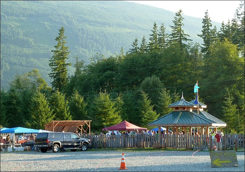
Down the road from the KOA was an event at a local brewery. They called it "Birdstock 2011" and it featured beer, brats and burgers for $4 each, plus a lineup of local live bands. What more could you ask?
We rode south on I-5 through Seattle on Sunday morning, expecting no traffic. Doh! The road wasn't packed, but there were plenty of cars and trucks all going 75 in a 60. We chose the HOV lane, figuring we'd only be exposed on one side. Good plan, except that the HOV lane was mostly paved shoulder, just tacked on to the main road. It was an exciting ride, needless to say, with beautiful views of the city as we sped by.
We stayed on the 5 south past Aberdeen, where we'd been before, and all the way to Kelso and Longview, where we crossed the Lewis and Clark Bridge to Rainier and turned west to Ft. Lewis State Park for a day of rest before going south toward L.A.
Lewis and Clark. There you go again.

Lewis and Clark Bridge between Longview, Wash., and Ranier, Ore.
No comments:
Post a Comment